
Utica ZIP Code Directory Coverage
Utica uses several postal labels, but the available records do not support drawing neighborhood lines around them. The safest description is tied to what USPS and other public institutions actually publish: an address may carry a Utica label, a station may use a ZIP range, and an older form may show a code that has since been combined. The Utica ZIP code directory is most useful when it keeps those facts separate instead of turning a delivery code into a claim about a block or a person.
| ZIP Code | Areas Covered | Post Office | Notes |
|---|---|---|---|
| 13501 | Utica postal label in local USPS and Census-facing context | Verify the complete delivery address with USPS | Not a fixed neighborhood boundary. |
| 13502 | Utica label, including a Butterfield Station ZIP range | Butterfield Station | Use a returned USPS address, not the code alone, to identify service. |
| 13503 | Utica postal label in applicable official lookup context | Verify with USPS | No supported geographic coverage description was found. |
| 13504 | Utica institutional postal label | Main Office and S&DC | USPS lists ranges for the facility, not a citywide residential boundary. |
| 13505 / 13599 | Historic postal-routing references | Combined to 13502 | Confirm a current address before relying on an older code. |
The table deliberately avoids unsupported neighborhood assignments. A ZIP result can be the right answer to a mailing question, while an election district, parcel, City boundary, or association area may follow an entirely different map. Note: Save the exact USPS result with the source date when an address appears on a form or historic record.
Verify a Utica ZIP Code First
The official USPS ZIP Code Lookup gives three different starting points: find a ZIP Code by address, find a ZIP Code by city and state, or find cities by ZIP Code. For a record question, the full-address route is the stronger one. It returns the Postal Service's delivery result for that address. USPS also cautions that its result does not verify an individual or organization at the address.
| USPS route | Input | Use in Utica research |
|---|---|---|
| ZIP by address | Complete address | Confirm a delivery ZIP before comparing a record. |
| ZIP by city and state | City and state | Find postal possibilities, then verify the full address. |
| Cities by ZIP | ZIP Code | Check the Postal Service's city labels without creating a boundary map. |
The USPS Utica location listing identifies the main office and S&DC at 100 Pitcher Street and shows its published ZIP ranges.
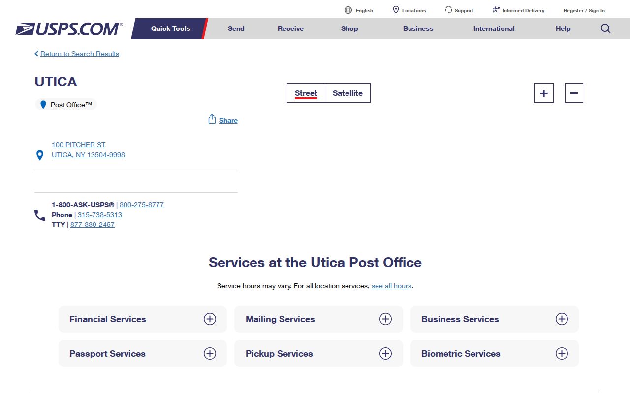
That facility page identifies a postal location. It does not establish a residential service boundary for every Utica address carrying a related ZIP Code.
Utica Postal Changes Need a Live Check
Older correspondence can carry a code that has changed. USPS Postal Bulletins for 2020 and 2021 show local combinations involving 13505, 13599, and 13502. That makes the former codes useful historical clues, not independent current geographies. Keep the code as printed in the old source, then run the present address through USPS before sending mail or joining it to a current parcel record.
The 2020 USPS Postal Bulletin is a useful source for documenting the earlier combination notice.
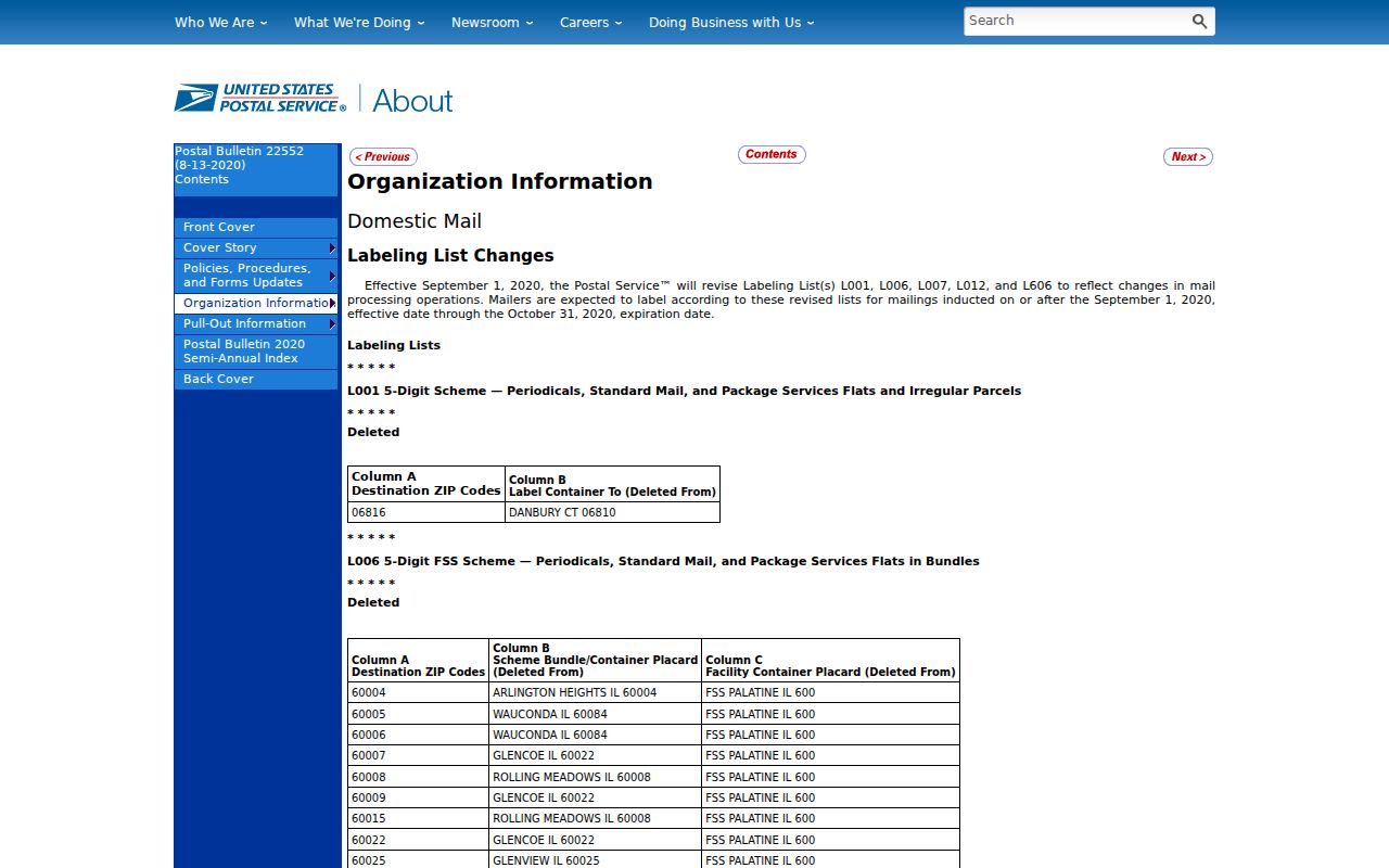
Its value is historical routing context. The exact delivery address remains the control for a current ZIP result.
The later 2021 USPS bulletin provides a second published reference for the Utica postal change.
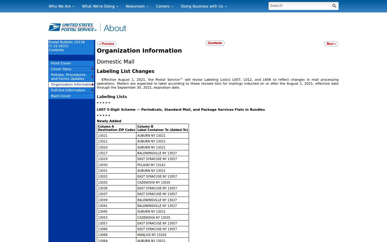
Reading the two notices together supports a verification step, not a guess that every older ZIP converts to one modern street area.
Utica Voter Lookup Uses a ZIP Code Field
The New York Voter Lookup includes County, last name, first name, date of birth, and ZIP Code. Oneida is an available county choice. That design is important: the ZIP field helps an individual registered voter confirm election information, but it does not make the tool a ZIP-wide people list or an address-only directory. Questions the form cannot answer belong with the Oneida County Board of Elections.
The official New York Voter Lookup screen shows the ZIP field alongside the other required identifying inputs.
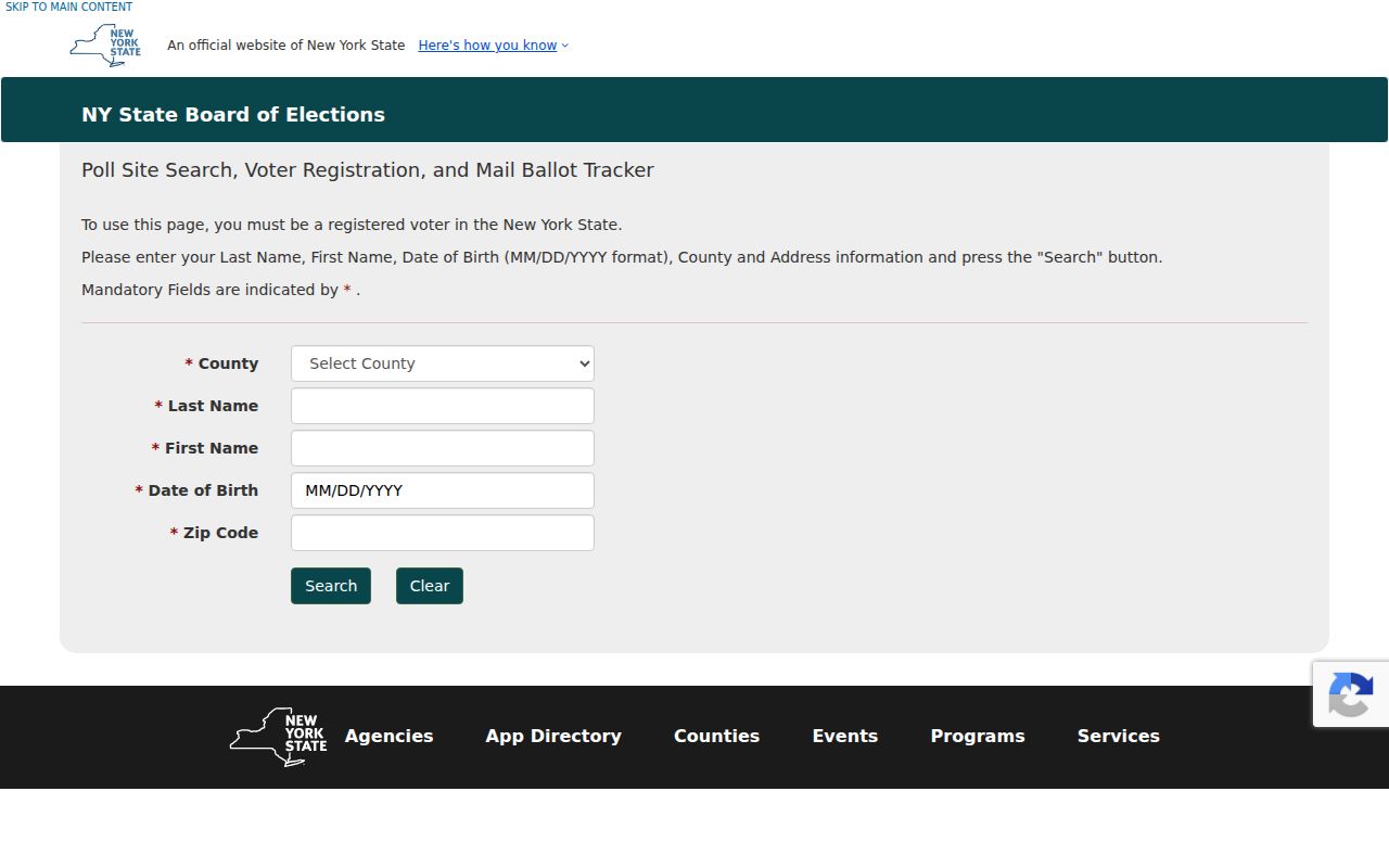
New York Election Law also limits voter-record access and protects qualifying confidential registrations, so a postal code cannot override the system's purpose or privacy rules.
Find a Utica Address After ZIP Verification
A verified code narrows a mailing question, but the official Utica property tools work from a street, parcel, or bill reference. The City tax self-service route accepts house number and street name in separate fields, or a parcel ID or bill number. It does not list a ZIP field. County GIS adds parcel geometry and mapped context. Treat each source as a different part of the same address trail.
- Enter the complete address in USPS Lookup and preserve the returned postal ZIP.
- Use the house number and street name in City tax self-service. Enter the street name without a suffix such as ST, AVE, or LN.
- Use the City result or known parcel ID to check the Oneida County parcel viewer for parcel context.
- For a public project or record question, name the property, date range, and document type to the City custodian or in a focused FOIL request.
When the goal becomes a street-by-street property trail, the Utica streets reference follows the address and deed paths in more detail. A ZIP should remain a postal check, not a substitute for the street or parcel identifier.
Utica ZIP Code Geography Is Not City Geography
The Census Bureau's ZCTA guidance explains the key distinction. A USPS ZIP Code is a delivery-routing designation. A ZIP Code Tabulation Area is a Census statistical approximation made from ZIP-related data. Neither automatically marks a Utica municipal limit, a neighborhood association boundary, an election district, or a school zone. The same address can belong to all of those systems while receiving a different answer from each.
The Census explanation of ZCTAs shows why a map label needs a source-specific reading.
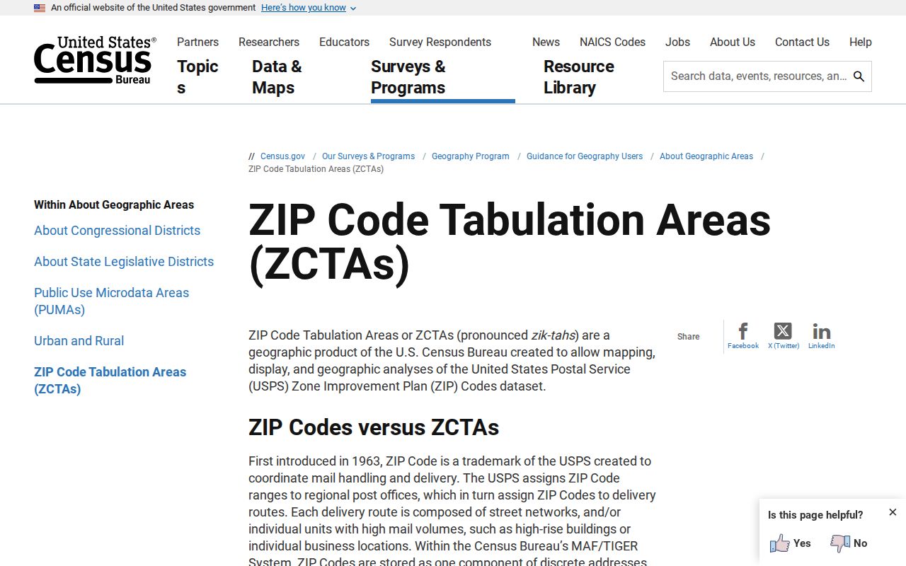
Use a ZCTA for statistical context only. Use USPS for delivery verification, City and County sources for local records, and election sources for political geography.
Utica Street and Parcel Records Answer More
ZIP filtering has firm limits in local record research. The City tax interface accepts address, parcel ID, or bill number rather than ZIP. The County GIS launch material describes parcel owner, address, assessed value, acreage, imagery, and layers such as floodplains, wetlands, contours, school districts, sewers, and soils, but its fields were not text-verifiable during the research. It is reasonable to map a known address there. It is not reasonable to promise a ZIP search mode the County has not documented.
Oneida County E911 addresses are also a separate system. The County describes an address as a number plus street name and gives modern parity and spacing rules. A postal ZIP cannot prove that a number is assigned correctly or establish a historical conversion. For an address that does not resolve, confirm the complete street address with USPS, then ask the relevant City or County custodian which record route applies.
Note: Keep a property location, owner mailing address, and parcel number as separate fields because they describe different parts of a record.
Utica Postal Research Needs a Source Log
When a Utica address appears in several record systems, preserve the result from each one instead of overwriting it with a single label. A USPS return describes postal delivery. The City tax route describes a tax or property query. A parcel viewer adds mapped land context. A voter form serves an individual election-information purpose. A historic directory has an edition date. That small distinction prevents a later researcher from treating a ZIP, a situs address, and a historic printed entry as if they all answered the same question.
| Source result | What to record | What it does not settle |
|---|---|---|
| USPS address result | Standardized address, returned postal code, and date checked | Identity, City boundary, or parcel ownership |
| Utica tax result | Search method, tax year, parcel or bill reference, and source fields | Every current household member |
| County parcel view | Parcel label, mapped location, and displayed layer date | Personal ties between adjoining properties |
| Historic directory or map | Edition or issue date, page or sheet, and printed address | Present-day delivery information |
This approach is particularly helpful for an old Utica document carrying 13505 or 13599. Retain the historical code as written and add the present USPS verification as a separate dated result. The City tax system's fiscal history begins in 2011/12, while the UPL directory scans cover selected years from 1817 through 1951. Neither time range should be stretched to fill a gap in the other. A County Clerk record, a library scan, or a focused City request can supply the next documented step when the postal result is not enough.
Utica ZIP Code Directory Limits and Terms
A precise Utica ZIP code directory should say what it cannot establish. USPS does not use a ZIP result to verify an individual or organization at an address. A City-labeled ZIP does not prove that a location is inside the City of Utica. Likewise, a map that displays 13502 as a ZCTA does not establish a USPS service area. Keep the question narrow: use the ZIP for mail, the parcel for land, the City tax source for a property record, and the Board of Elections for election procedures.
- ZIP Code and ZIP+4
- A ZIP Code identifies a broad postal routing area; ZIP+4 adds a more specific delivery segment within that system.
- PO Box ZIP
- A postal code may be used for box delivery. It should not be treated as a neighborhood or a physical-address map.
- Unique ZIP
- A code or extended range can be associated with a postal facility or organization, but the official result controls its current use.
- Carrier route
- A delivery grouping used by the Postal Service. It is not a municipal boundary, voter district, or public resident roster.
Use these distinctions for lawful, personal address research. Do not use public records or postal details to watch, harass, or harm another person.